Mount Sherman Hiking Guide (Colorado 14er)

Updated: Jul 16

Mount Sherman is often considered one of the most approachable Colorado 14ers, making it a popular choice for hikers beginning their journey toward summiting Colorado’s highest peaks.
Located in the Mosquito Range near Leadville, Mount Sherman stands at 14,043 feet and offers wide-open alpine views with a relatively short route compared to many other Colorado 14ers.
This Mount Sherman hiking guide covers the standard route near the Fourmile Creek Trailhead, what the climb feels like, and what to expect while hiking one of the state’s most beginner-friendly summits.
For me, this climb marked my third Colorado 14er and another step toward my goal of summiting all 58 peaks.
You can follow the entire journey in my Colorado 14er Hiking Guide, where I document every climb along the way.
This climb is 14er #3 of 58.
With its wide-open alpine views and historic mining landscape, Mount Sherman offers a unique Colorado experience. If you’re thinking about eloping in a place like this, you can explore my Colorado Elopement Guide for ideas and planning tips.
Table of Contents
Mount Sherman Quick Hiking Guide
Here are the key details for the standard route.
• Trailhead: Fourmile Creek Trailhead near Leadville
• Elevation: 14,043 ft
• Distance: ~5 miles round trip
• Elevation Gain: ~2,100 ft
• Route: Southwest Ridge
• Difficulty: Class 2 hike
• Typical Time: 3 to 4 hours round trip
• Best Season: June through September
Mount Sherman is widely considered one of the shorter and more approachable Colorado 14ers, which makes it a popular option for hikers beginning their 14er journey.
Getting to the Fourmile Creek Trailhead
Mount Sherman is located in the Mosquito Range near Leadville, Colorado.
Most hikers access the mountain from the Fourmile Creek Trailhead, which sits at high elevation and allows for a relatively short hike to the summit.
The road to the trailhead can be rough in sections, with rocks and bumps along the way, but the surrounding mountain scenery makes the drive part of the adventure.
Because of the high starting elevation, hikers begin the climb already well above 11,000 feet.
Driving & Parking Information
For this hike, I drove my 2015 Subaru Outback 2.5i Premium, which made it nearly all the way to the Fourmile Creek Trailhead without any issues.
The drive is noticeably rougher than some of Colorado’s more accessible 14ers. Expect a rocky dirt road with plenty of bumps, loose rocks, and uneven sections as you climb toward the trailhead. While the road requires slow, careful driving, I found it completely manageable in my stock Subaru Outback.
One thing that really stands out is the elevation. By the time you reach the trailhead, you’re already around 12,000 feet, making it one of the highest starting trailheads for any Colorado 14er.
Vehicle
2015 Subaru Outback 2.5i Premium
Road Conditions
🟡 Moderate
The road is rocky and uneven in several places, so take your time. While I had no problems reaching the trailhead in my Subaru Outback, lower-clearance passenger cars may need to drive more cautiously depending on current road conditions.
Parking
Free parking near the Fourmile Creek Trailhead
Large parking area
No reservation required during my visit
I arrived the evening before and found plenty of space to camp near the trailhead
Would I Drive It Again?
Absolutely. My Subaru Outback handled the road well, and I’d have no hesitation driving it there again. Just expect a slow, bumpy drive and enjoy the incredible scenery on the way up.
Camping Near the Mount Sherman Trailhead
I arrived the evening before and camped just below the trailhead at around 12,000 feet.
Sleeping at that elevation surrounded by quiet peaks felt surreal.
The alpine air was cold and crisp, and the night sky was completely filled with stars.
Spending the night near the mountain also makes it easier to start early and enjoy the calm morning conditions before other hikers arrive.
Mount Sherman Route Overview
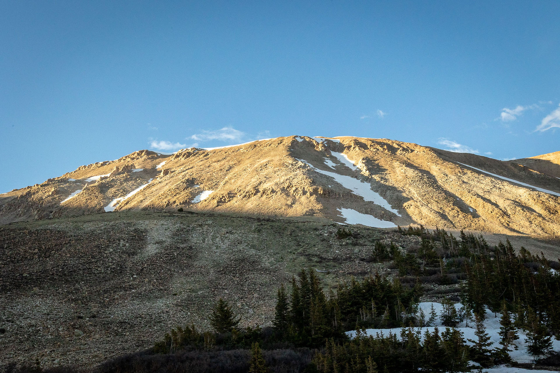
The standard route begins by following an old mining road that winds gradually upward through the alpine landscape.
Historic mining structures still dot the mountainside, offering a glimpse into Colorado’s mining history.
Unlike some Colorado 14ers that require scrambling, Mount Sherman is mostly steady hiking with gradual elevation gain.
As the trail climbs higher, the route eventually reaches the summit ridge where the final push to the top begins.
Because of the relatively short distance and clear route, Mount Sherman is often recommended as a great first Colorado 14er.
The Climb to the Summit
I woke up around 5:00 to 5:30 a.m. and started hiking shortly after sunrise.
The early morning light painted the surrounding peaks with warm golden colors, and the mountain felt calm and peaceful.
Compared to some longer 14er hikes, this climb felt short and manageable.
The entire round trip took just under 3.5 hours, making it one of the quicker summits I’ve experienced.
Even so, the altitude reminds you that you are still climbing above 14,000 feet.
Trailhead Encounters
One of the highlights of the day was meeting two brothers from Wisconsin who were also hiking Colorado 14ers.
We ended up chatting on the way down, sharing stories about the mountains and enjoying the views together.
These kinds of unexpected conversations are part of what makes hiking Colorado’s peaks so memorable.
The mountains have a way of bringing people together.
Safety Tips for Hiking Colorado 14ers
Even though Mount Sherman is considered a beginner-friendly 14er, hikers should still prepare for alpine conditions.
Important considerations include:
• Rapidly changing weather
• Afternoon thunderstorms in summer
• Altitude sickness
• Strong winds above treeline
• Limited shelter on the mountain
Starting early and monitoring weather conditions is always a good idea when hiking Colorado’s high peaks.
The mountains will always be there if you need to turn around.
Other Colorado 14ers in My Journey
Mount Sherman was the third peak in my goal of climbing all 58 Colorado 14ers.
You can follow the full journey in my Colorado 14er Hiking Guide.
If you’re exploring Colorado’s mountains, you might also enjoy reading about these other climbs:
Each mountain offers a unique experience and a different perspective on Colorado’s alpine landscapes.
Frequently Asked Questions About Mount Sherman
Is Mount Sherman a good beginner 14er?
Yes. Mount Sherman is widely considered one of the best beginner Colorado 14ers because of its shorter distance and relatively moderate elevation gain.
How long does it take to hike Mount Sherman?
Most hikers complete the round trip in 3 to 4 hours, depending on pace and time spent on the summit.
How difficult is Mount Sherman?
The hike is considered Class 2, meaning it is mostly straightforward hiking without technical climbing.
When is the best time to hike Mount Sherman?
Most hikers climb Mount Sherman between June and September when the trail is typically snow-free.
Why Colorado’s Mountains Inspire Elopements
Spending time in Colorado’s alpine landscapes has shown me how powerful these places can be.
Many couples who love hiking and adventure choose to celebrate their relationship somewhere wild and meaningful.
Colorado’s mountains offer some of the most breathtaking backdrops in the world for intimate elopements.
If you’re ready to start planning your own mountain elopement, you can explore my Colorado elopement packages and pricing to see how it all works.
📩 If you’d like help planning a mountain adventure or elopement, you can also reach out through my contact page and tell me about your vision.
Bring the Wild to Your Walls
There’s something special about standing on a Colorado summit surrounded by endless mountains.
Photography allows me to preserve those moments long after the hike is over.
If one of these landscapes speaks to you, you can explore my Colorado fine art mountain prints and bring a piece of Colorado’s alpine beauty into your home.
Each photograph is captured during real adventures in the mountains and printed as museum-quality artwork.
Safety Notice
This guide reflects my personal experience hiking Mount Sherman via the standard route from Fourmile Creek Trailhead near Leadville, Colorado. Mountain conditions, trail conditions, weather, access, and route information can change at any time.
Please review my Mountain Safety & Disclaimer page before planning your hike. Always conduct your own research, check current conditions, carry appropriate gear, and make decisions based on your own experience and judgment while in the mountains.




Comments